Contact   Imprint   Advertising   Guidelines

Seriously Strong Wind On The Way?

Forum for kitesurfers
SupaEZ
Very Frequent Poster
Posts: 2966
Joined: Sun Jun 12, 2011 12:47 pm
Local Beach: Space coast Florida 5th street
Favorite Beaches: One block from condo
Style: surfboard strap waves transitions
Gear: Boards quads & tri
Kites19-17-12-10-8-6-5 sqm
Has thanked: 0
Been thanked: 1 time

Re: Seriously Strong Wind On The Way?

Postby SupaEZ » Wed Oct 24, 2012 8:56 pm

Dimitri M wrote:
Poster: plummet
sounds epic. i crave 30+ knots and big seas. send some my way!...
Yes it is going to be EPIC here on the Outer Banks.
:thumb:
In the meantime today wednesday and thursday..you have an Epic 7 knots of wind forecasted

........... :wink: ..............................................................

Dan Glyaire
Frequent Poster
Posts: 339
Joined: Fri Oct 28, 2005 8:11 pm
Has thanked: 0
Been thanked: 0

Re: Seriously Strong Wind On The Way?

Postby Dan Glyaire » Wed Oct 24, 2012 10:40 pm

Kevin would go.

User avatar
jasontsai
Medium Poster
Posts: 107
Joined: Mon Jun 07, 2004 3:05 am
Local Beach: Taiwan
Favorite Beaches: Taiwan, Maui
Style: Waves, Foiling
Gear: North Neo, Mono, Dice, Whip
Has thanked: 0
Been thanked: 0

Re: Seriously Strong Wind On The Way?

Postby jasontsai » Thu Oct 25, 2012 3:18 am

With steadier wind and better waves, usually the outer region of a TS is more fun than the center region. The wind is often very very gusty with heavy rain near the center of the storm.

In Taiwan we get several typhoons a year. Here are two pics of the outer region when the eye of the typhoon is still about 500 km from us - good waves, wind 20-30 knots:
Image
Image

Here is a pic near the eye of the typhoon - big rough waves, very gusty wind 10-60 knots:
Image

Same spot with a spring breeze:
Image

Good luck out there.
Last edited by jasontsai on Fri Oct 26, 2012 1:40 am, edited 1 time in total.

User avatar
RickI
Very Frequent Poster
Posts: 9118
Joined: Mon Feb 11, 2002 1:00 am
Local Beach: SE Florida
Gear: Cabrinha
Brand Affiliation: Cabrinha
Location: Florida
Has thanked: 88 times
Been thanked: 102 times

Re: Seriously Strong Wind On The Way?

Postby RickI » Thu Oct 25, 2012 4:13 am

Nice images and good information, thanks for posting jasontsai. You have been having active typhoon seasons for some years too. Good luck through the rest of this season.

User avatar
RickI
Very Frequent Poster
Posts: 9118
Joined: Mon Feb 11, 2002 1:00 am
Local Beach: SE Florida
Gear: Cabrinha
Brand Affiliation: Cabrinha
Location: Florida
Has thanked: 88 times
Been thanked: 102 times

Re: Seriously Strong Wind On The Way?

Postby RickI » Thu Oct 25, 2012 4:25 am

Here is some more recent information on now Hurricane Sandy. They are saying it might build in strength to Cat. II and is to turn back into a hurricane over the Bahamas following being weakened over Cuba. Interests in impacted areas need to monitor this system closely.

Image
From Passageweather.com

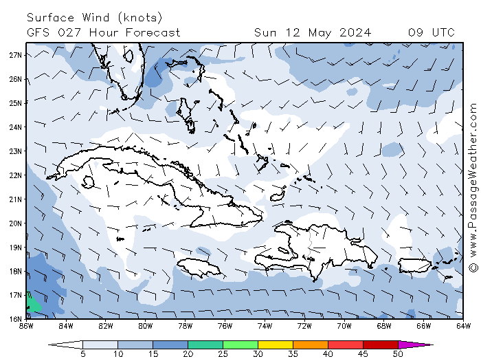
Here is one model forecast for the wind field and organization of Sandy at 4 pm local time tomorrow, Thursday.

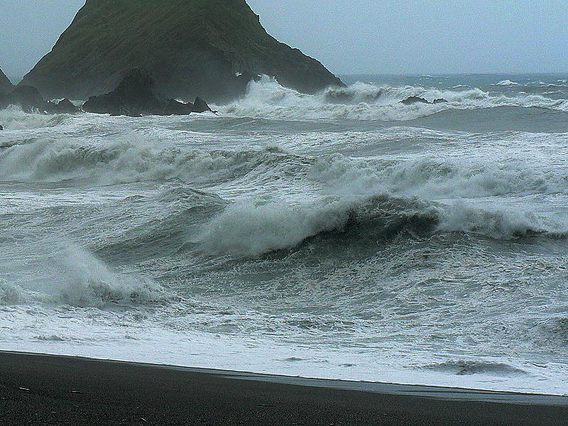
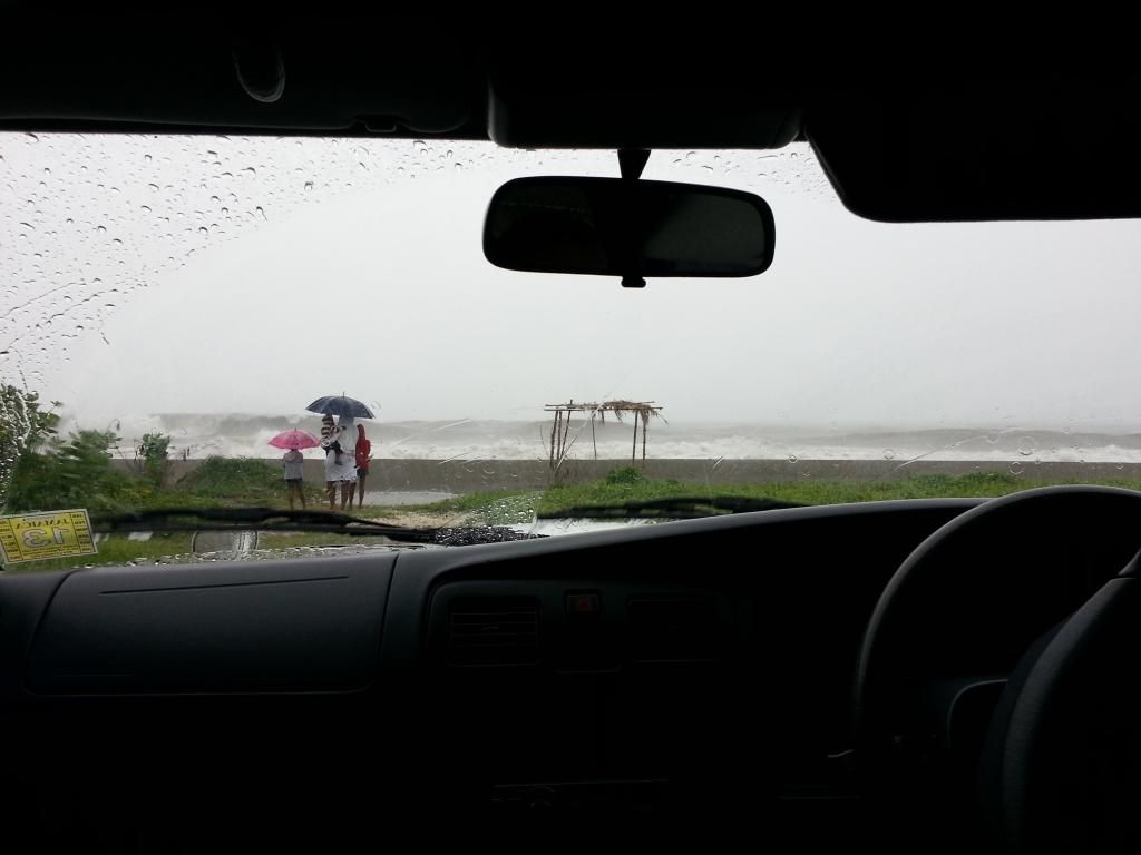
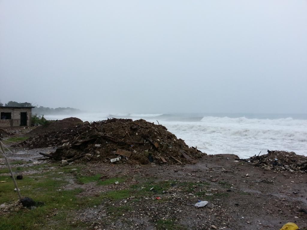
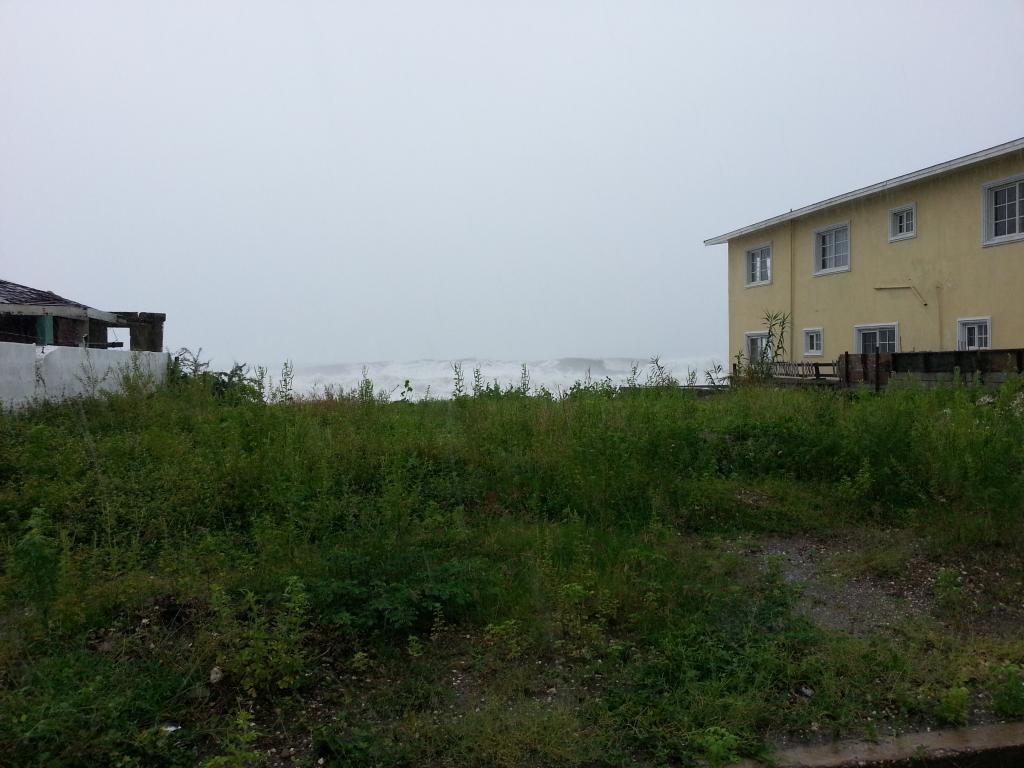
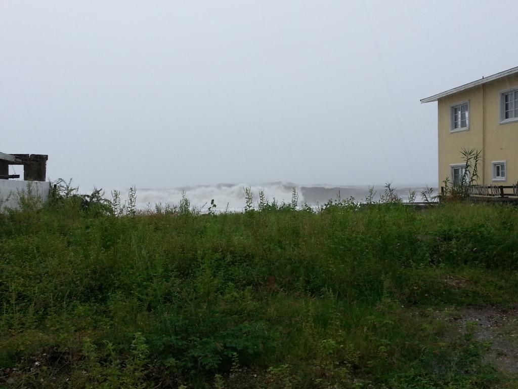
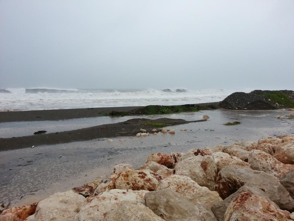
Looking at the current satellite imagery it seems reasonable that we may have some serious squalls at points in Florida from feeder bands as Sandy moves north.


Image
http://www.wunderground.com/data/
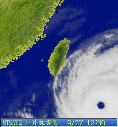
A look at the basin satellite imagery


Image
http://www.wunderground.com/
A closer look at Florida, some feeder bands are already sliding over Florida Tuesday afternoon.


Image
http://www.nhc.noaa.gov


Be sure to monitor http://www.nhc.noaa.gov/ and http://fksa.org/showthread.php?t=1609 as this system passes through to try to avoid nasty surprises.


Here is the NWS forecast for Palm Beach County. This will change in the coming days how much in what way is uncertain at this time.

"Coastal waters from Jupiter Inlet to Deerfield Beach FL out 20 NM

Rest Of Tonight: East northeast winds 16 to 21 knots along the coast to east northeast 21 to 26 knots in the gulf stream. Seas 8 to 10 feet with occasional seas up to 13 feet. Dominant period 7 seconds. Intracoastal waters rough in exposed areas. Chance of showers.

Thursday: Northeast winds 24 to 29 knots with gusts to around 40 knots along the coast to northeast 25 to 30 knots with gusts to around 40 knots in the gulf stream. Seas 10 to 12 feet with occasional seas up to 15 feet. Dominant period 8 seconds. Northeast swell 3 feet increasing to east northeast 3 to 4 feet in the afternoon. Intracoastal waters very rough in exposed areas. Chance of showers. Slight chance of thunderstorms in the afternoon.

Thursday Night: Along the coast...north northeast winds 25 to 30 knots with gusts to around 40 knots becoming north 32 to 37 knots with gusts to around 50 knots...seas 14 to 17 feet with occasional seas up to 20 feet. In the gulf stream...north northeast winds 31 to 36 knots with gusts to around 50 knots becoming north 37 to 42 knots with gusts to around 60 knots... Seas 18 to 22 feet with occasional seas up to 25 feet. Seas 11 to 13 feet with occasional seas up to 17 feet in the evening. Dominant period 10 seconds. Intracoastal waters extremely rough. Showers likely and chance of thunderstorms.

Friday: North northwest winds 37 to 42 knots with gusts to around 60 knots along the coast to northwest 45 to 50 knots with gusts to around 65 knots in the gulf stream. Along the coast... Seas over 20 feet with occasional seas up to 27 feet building to over 20 feet with occasional seas up to 31 feet in the afternoon. In the gulf stream...seas over 20 feet with occasional seas up to 38 feet building to over 20 feet with occasional seas up to 45 feet in the afternoon. Dominant period 11 seconds. Intracoastal waters extremely rough in exposed areas. Showers likely and chance of thunderstorms.

Friday Night: Along the coast...northwest winds 33 to 38 knots with gusts to around 55 knots becoming west northwest 25 to 30 knots with gusts to around 40 knots...seas over 20 feet with occasional seas up to 29 feet subsiding to 16 to 20 feet with occasional seas up to 23 feet. In the gulf stream...west northwest winds 39 to 44 knots with gusts to around 60 knots... Seas over 20 feet with occasional seas up to 41 feet subsiding to over 20 feet with occasional seas up to 36 feet. Intracoastal waters extremely rough in exposed areas. Chance of showers and slight chance of thunderstorms.

Saturday: West northwest winds 25 to 30 knots along the coast to west northwest 30 to 35 knots in the gulf stream. Gusts up to 50 knots. Along the coast...seas 12 to 14 feet with occasional seas up to 18 feet. In the gulf stream...seas over 20 feet with occasional seas up to 29 feet subsiding to 18 to 22 feet with occasional seas up to 25 feet in the afternoon. Intracoastal waters rough in exposed areas. Slight chance of showers.

Saturday Night: Northwest winds 18 to 23 knots along the coast to northwest 24 to 29 knots with gusts to around 40 knots in the gulf stream. Along the coast...seas 11 to 13 feet with occasional seas up to 17 feet. In the gulf stream...seas 17 to 21 feet with occasional seas up to 24 feet subsiding to 14 to 17 feet with occasional seas up to 20 feet. North swell 5 to 8 feet. Intracoastal waters choppy in exposed areas. "

http://www.srh.noaa.gov/mfl/


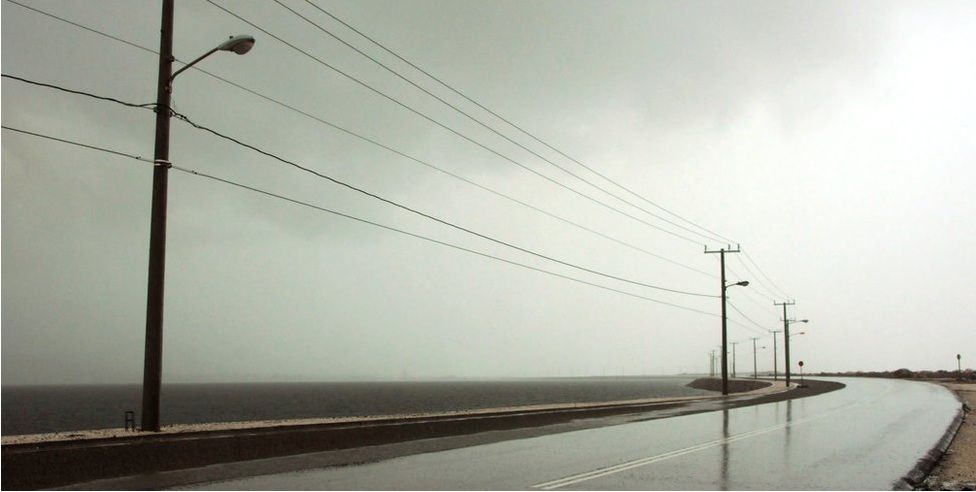
Today, well away from squalls, kiting was excellent off Palm Beach County. Looks like the best days for kiting associated with Sandy may be over from the forecast however. The forecast for tomorrow for this area has been moving up and down quite a bit. Friday looks to be blown out and offshore anyway. The wind field from this system is massive and it impacts a good deal more than that small area. Some areas won't be kiteable due to excessively strong and gusty winds. In short local conditions govern, use your head and appropriate restraint. Good frontal winds should return within days, no need to panic about getting out to ride in this mess as conditions are to deteriorate sharply.


Continued HERE

FKA, Inc.

transcribed by:
Rick Iossi

.

naishdude
Very Frequent Poster
Posts: 968
Joined: Tue Oct 14, 2008 9:14 am
Local Beach: Holland
Spain
Danemark
France
Favorite Beaches: everywhere at the seaside, where it is allowed to kite
Style: cruising& wave
Gear: Airush Sector 54 V5, Cypher5'8 active, compact 5'6, Compact5'5 active, Limit Waves custom 5'6
Ozone reo V5 12 9 7 5
Brand Affiliation: none
Location: outer space
Has thanked: 6 times
Been thanked: 6 times

Re: Seriously Strong Wind On The Way?

Postby naishdude » Thu Oct 25, 2012 7:45 pm

More from the Federal Government. Expected to come ashore in New Jersey but to affect very wide areas. Worst conditions will be northeast and northwest of the landfall point, i.e. NYC and Long Island. High winds, heavy rain, deep snow and flooding. This will be the year without a Halloween here.

http://poststar.com/news/national/noaa- ... 963f4.html

An unusual nasty mix of a hurricane and a winter storm that forecasters are now calling "Frankenstorm" is likely to blast most of the East Coast next week, focusing the worst of its weather mayhem around New York City and New Jersey.

Government forecasters on Thursday upped the odds of a major weather mess, now saying there's a 90 percent chance that the East will get steady gale-force winds, heavy rain, flooding and maybe snow starting Sunday and stretching past Halloween on Wednesday.

Meteorologists say it is likely to cause $1 billion in damages.

The storm is a combination of Hurricane Sandy, now in the Caribbean, an early winter storm in the West, and a blast of arctic air from the North. They're predicted to collide and park over the country's most populous coastal corridor and reach as far inland as Ohio.

While the dangerous storm is still days away, the probability of the feared left hook has increased and will take place during a big atmospheric fight from the mid-Atlantic to New England and neighboring Canada. The result could be a knockout blow to some areas and not only along the immediate coast.

Tens of millions of people and thousands of communities could be impacted by the storm.

User avatar
MattyRossJa
Medium Poster
Posts: 187
Joined: Thu Feb 23, 2012 5:16 pm
Local Beach: Maiden Cay , Jamaica
Favorite Beaches: Maiden Cay , Bounty Bay , Round Hill , Pigeon Island (all jamaica)
Style: Freeride learning Freestyle
Gear: 2011 Cabrinha 10 Switchblade ... 2012 Cabrinha Chopstick
Brand Affiliation: None
Location: Jamaica
Has thanked: 0
Been thanked: 0

Re: Seriously Strong Wind On The Way?

Postby MattyRossJa » Thu Oct 25, 2012 9:02 pm

we went out to check the conditions as Sandy approached almost a direct hit on kingston. the regular surfers were having a terrible time getting to the break , some managed and had some fun. as for kiting , there was almost no wind until the big stuff reached , there was no gradual increase in wind...

Kingston harbour is sheltered nicely and this is where we would have tried to kite as the surge was just too crazy on the seaside
. however the wind wasn't great at this time so we heading back home to hunker down.

Image

Image

Image

Image

Image

Image

Image

Da Yoda
Very Frequent Poster
Posts: 1358
Joined: Wed Dec 14, 2005 6:20 pm
Kiting since: 2005
Style: Strapless Freestyle, Wave, Freeride
Gear: Handmade Surfboards
Location: Western USA
Has thanked: 6 times
Been thanked: 172 times

Re: Seriously Strong Wind On The Way?

Postby Da Yoda » Fri Oct 26, 2012 7:33 pm

Dan Glyaire wrote:Kevin would go.
Kevin... Where are you at? We're waiting for your encore. It's been 4 years now.
Don't let Sandy down. She likes "turtles" you know. :lol:

peterheirman
Medium Poster
Posts: 170
Joined: Fri Jul 29, 2011 10:17 am
Local Beach: 2002
Brand Affiliation: None
Has thanked: 0
Been thanked: 0

Re: Seriously Strong Wind On The Way?

Postby peterheirman » Fri Oct 26, 2012 8:05 pm

Up to 45 knots happens quite often in The Netherlands - which is feasible t kitesurf with a 5m or 4m kite
No panic.

chipmunk
Frequent Poster
Posts: 470
Joined: Tue Dec 13, 2005 10:41 pm
Brand Affiliation: None
Location: ZZ 9 Plural Z Alpha UK
Has thanked: 0
Been thanked: 0

Re: Seriously Strong Wind On The Way?

Postby chipmunk » Fri Oct 26, 2012 8:20 pm

The Speed boy's will love IT :thumb:
viewtopic.php?f=1&t=2377968


Return to “Kitesurfing”